
What is checked
An hour is green only if every source has answered
And none of them has anything to report. Not knowing is not an authorisation: if a source cannot be reached, botic says so and names what the silence leaves open, rather than counting doubt as a green light.
The geographical zones at that hour
Not “right now”. A military area closed in the morning may open in the afternoon, and the other way round. Source: the official droneguide feed.
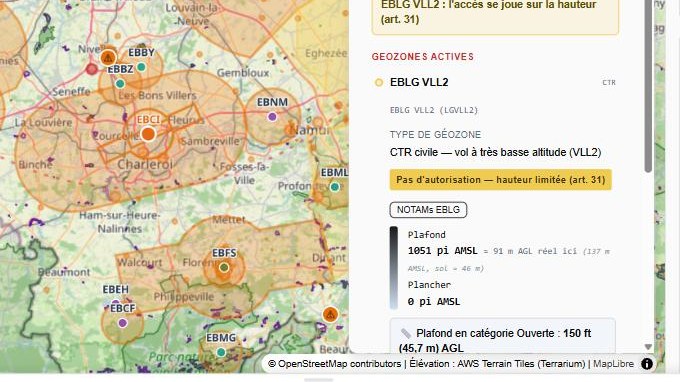
The upper limit actually allowed
Often far lower than the 120 m of the Open category: 35 ft near some military areas, 150 ft under an approach path.
Nature reserves
Absent from every drone map. Queried separately from the SPW, the Agentschap Natuur en Bos and Brussels Environment.
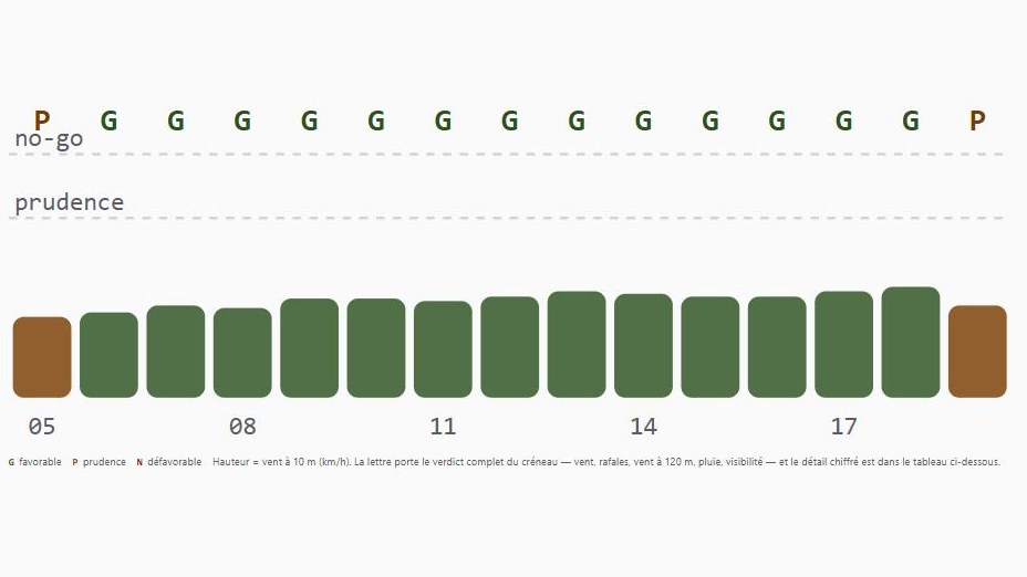
Weather, daylight and warnings
Wind, gusts, rain and visibility hour by hour, the sunrise–sunset window, and skeyes Daily Warnings within a 15 km radius.
In three steps
An address, a time slot, your aircraft
The rest is cross-checking — the kind of work nobody wants to redo by hand before every flight.
You place the point
An address or a click on the map. Zone lower limits published in MSL are converted using the real terrain elevation, never assumed.
You give the time
The intended time slot, not the present moment. Every source is queried for that hour, and the whole day is rendered hour by hour.
You get what is missing
Not just a light. The constraint that blocks, the margin under the upper limit, the authorisation to request — and from whom.
The app
Nearly 800 zones, cross-checked live
Screenshots taken in botic, unstaged. The number of zones changes from day to day: they are re-read from the official feed, not frozen into a map.

Georeferenced drone photo
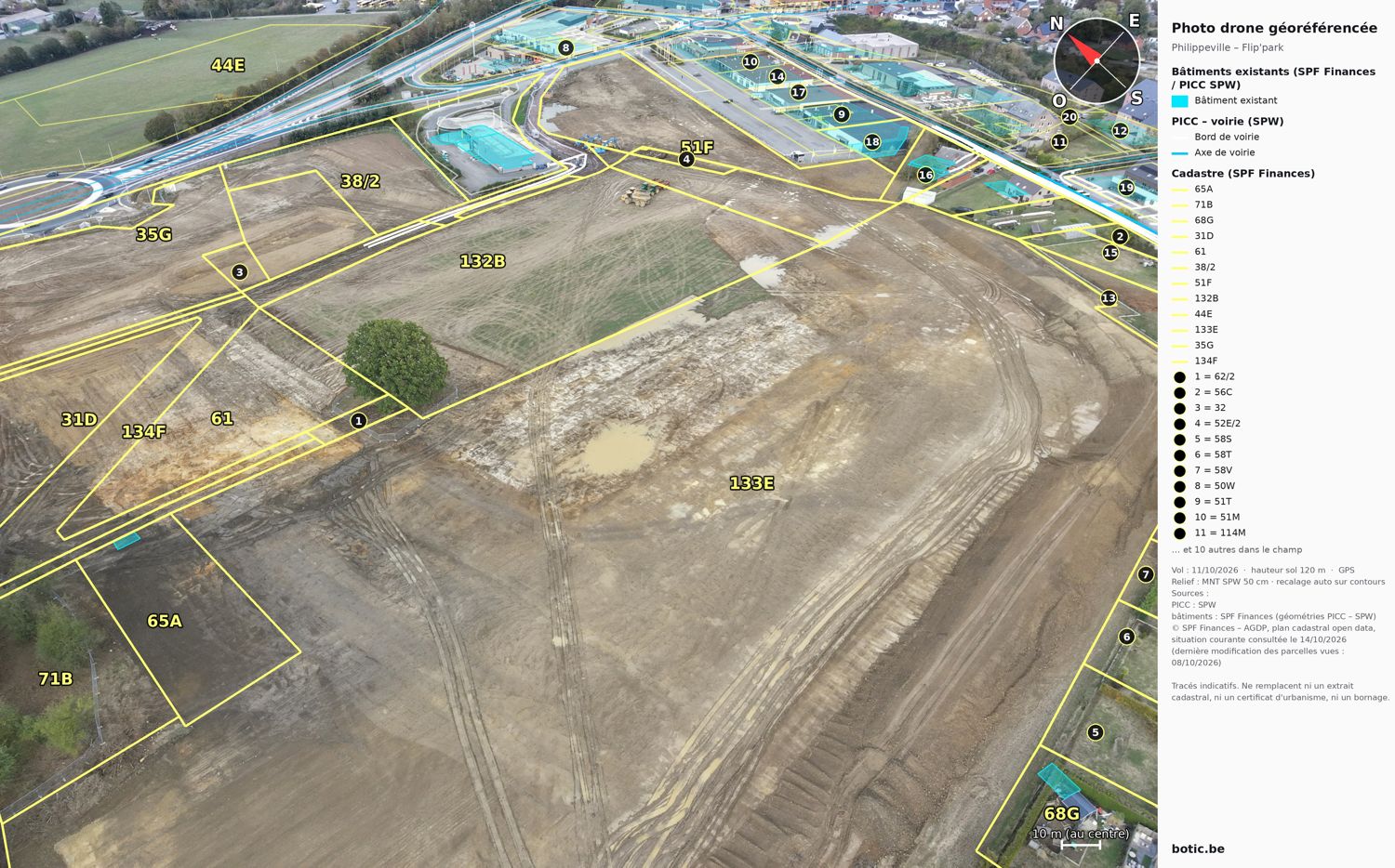
Official boundaries, drawn on your photo
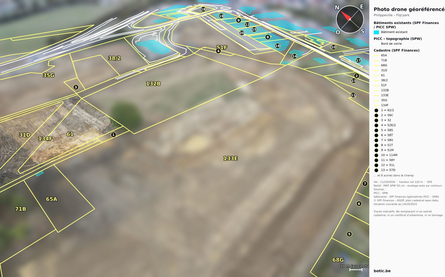
botic overlays the cadastre, buildings, zoning plan or flood zones on a drone photo, vertical or oblique, taking the terrain relief into account. For a mandate, neighbouring plots can be blurred.
For estate agencies
“Where does the land end?” The answer is on the photo, with the official cadastral area, north, scale and the dated source.
Official sources
Cadastre and buildings: FPS Finance. Zoning plan, flood hazard, agricultural plots, relief: SPW. Flemish and Brussels equivalents. Every image carries its sources.
An indicative overlay
The overlay replaces neither a cadastral extract nor a boundary survey, and every image says so.
Limits
What botic does not do
A stated limit is worth more than an assumed coverage. Here is the one that matters.
NOTAMs are not cross-checked geographically
Their text is semi-structured and their position not always usable. They must be consulted separately before every flight — botic reminds you at every verdict rather than pretending it has read them. skeyes Daily Warnings, on the other hand, are filtered by radius and by time slot.
botic is not an official source and issues no authorisation. Only map.droneguide.be is authoritative in Belgium. Responsibility for the flight remains entirely the remote pilot's.